
Based on satellite soil moisture and precipitation data (currently ERA5 precipitation), the system provide operationally the probability of landslide throughout Italy.
https://platform.dtehydrology.org/italy-landslide-preoperational
You get access after login (free registration)
The service seems to work good. Below the maps for 28th August (latest map we have). Landslide hazard in the Piemonte Region, that unfortunately happened with landslide events actually occurred. From the media:
On 28 August 2026, a sudden spell of bad weather hit Piedmont, causing landslides in the Turin area, notably leading to the closure of the road in the Argentera Valley between Sauze di Cesana and Argentera.
https://www.ansa.it/sito/notizie/cronaca/2026/08/28/frane-nel-torinese-strada-chiusa-nella-notte-per-il-maltempo_da2d8496-f2e8-4729-9019-501b76d60953.html
Rescue operations: The Fire Brigade’s ‘Drago’ helicopter was deployed in the afternoon to rescue eight people threatened by landslides.
https://www.vigilfuoco.tv/piemonte/torino/sauze-di-cesana/maltempo-torino-elicottero-vf-porta-salvo-8-persone-minacciate-da
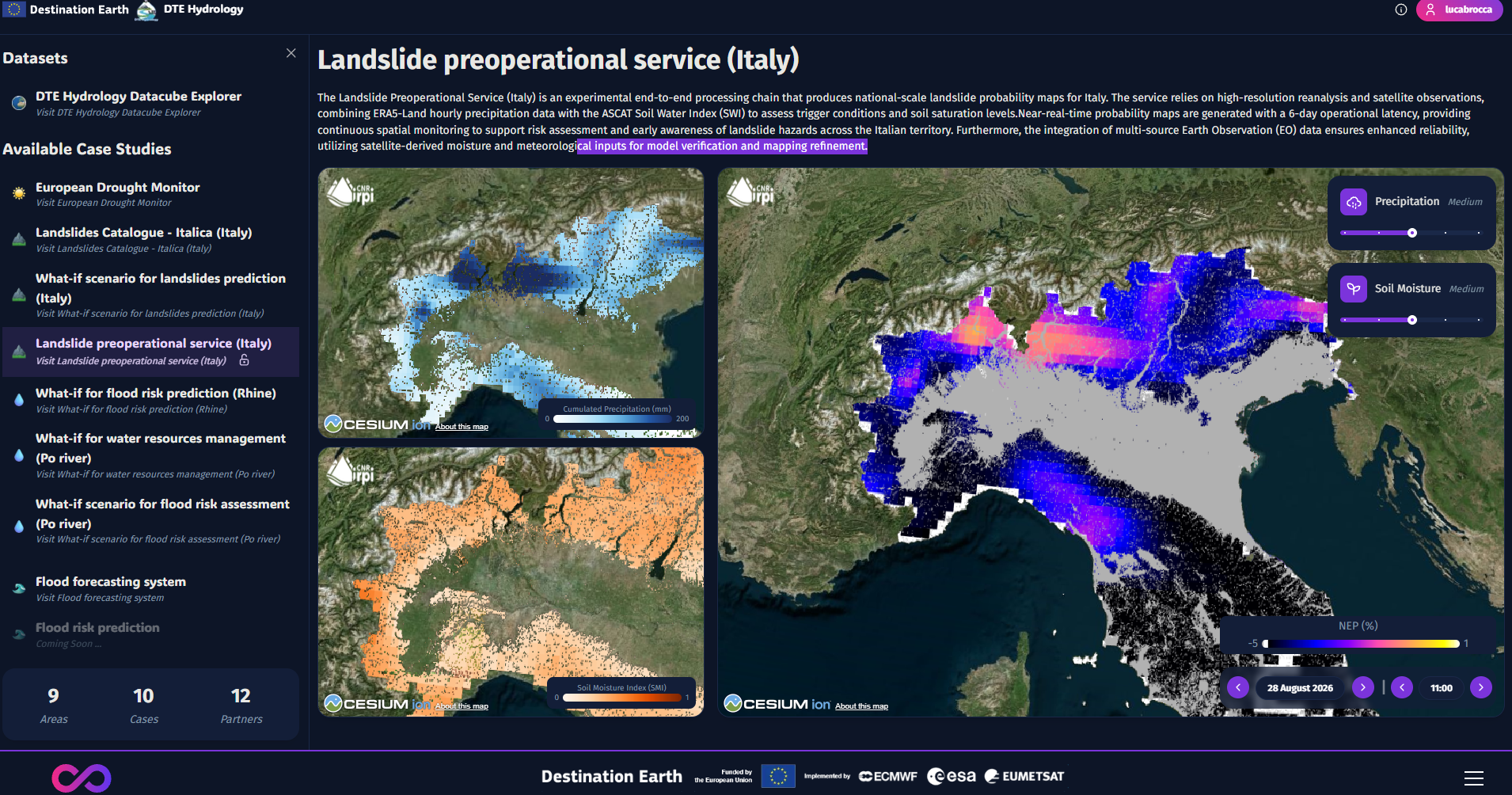
Now we have two operational services with real-time data ingestion: (1) drought monitoring throughout Europe, (2) landslide hazard throughout Italy